Google Maps
We like Google Maps app for navigating to a trailhead or trail parking lot. The Rail Trailster always uses Google Maps GPS coordinates for trailheads and parking lots in the Trail Summary section. Read why we don’t recommand Apple Maps for this.
However, we do not recommend Google Maps for trail navigation.
There are several ways we’ve tried to use Google Maps for trail navigation:
Embed a Google map with GPS coordinates
Section titled “Embed a Google map with GPS coordinates”Embed a Google Map on a website like this. Note first that Google Maps identifies the POI Clarence Pathways (Parking) with the western trailhead at Wehrle Drive. This is correct. It did well. Now click/tap View larger map and notice that the starting location and destination have been changed to POIs and that the starting trailhead has been moved to the Salt Road parking lot! Oops. You’ve used Google Maps to arrive successfully at the Wehrle Drive trailhead and it seems to have suddenly moved to Salt Road.
When you use GPS coordinates to get walking or cycling directions for navigating the trail itself, Google Maps doesn’t retain the GPS cooridinates. Instead, it seems to substitute one of the POIs in its database for both start and end trailheads. Click/tap on More options in the map below and you’ll see what I mean.
Embed a Google map with POIs
Section titled “Embed a Google map with POIs”Suppose we abandon GPS coorinates for trailheads and use POIs instead? The embedded map below does exactly that.
This looks promising. Click/tap More options. If you’re far from the starting trailhead, Google Maps will show a preview of the trail. If you’re close, it will show turn-by-turn navigation.
Use a universal link 1 to Google Maps with GPS coordinates
Section titled “Use a universal link 1 to Google Maps with GPS coordinates”Let’s try another technique: click/tap this univeral link to a Google map ![]() .
.
Wow, that worked perfectly. Again, if you’re far from the starting trailhead, Google Maps will show a preview of the trail. If you’re close, it will show turn-by-turn navigation.
Use a universal link to Google Maps with POIs
Section titled “Use a universal link to Google Maps with POIs”Click/tap this univeral link to a Google map ![]() . That worked perfectly. Preview vs navigation view applies again.
. That worked perfectly. Preview vs navigation view applies again.
No cell or wifi service
Section titled “No cell or wifi service”
So several of these options work perfectly when you have cell service. What happens when you don’t?
Let’s suppose you know there’s no cell service at the trailhead, so you downloaded a map centered on Clarence, NY, to your smartphone. You made sure that the map contains the whole trail. You would have done this by following these instructions ![]() ahead of arriving at the trailhead.
ahead of arriving at the trailhead.
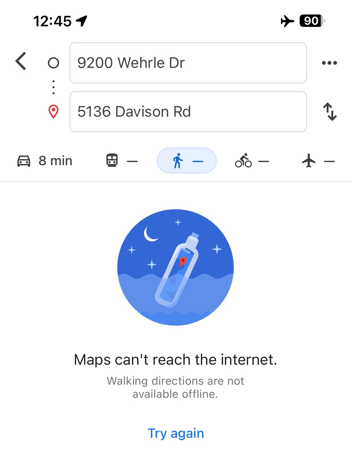
You arrive at the trail and click/tap one of the navigation links above that work. You remembered to load this page into your browser when you had cell service. But even though you have downloaded a map, it still doesn’t work. Walking and cycling directions are not available offline!
Conclusion: we don’t recommend using Google Maps for trail navigation.
Section titled “Conclusion: we don’t recommend using Google Maps for trail navigation.”Footnotes
Section titled “Footnotes”-
A universal link works both in a browser and in Google Maps app with Android and Apple devices. ↩