Great Gorge Railway Trail, Niagara Falls, NY

The Great Gorge Railway Trail is a 1.1 mile rail trail in the city of Niagrara Falls, NY. Its one trailhead is near Great Lakes 360 (formerly Niagara Gorge Discovery Center). This is at the western end of Walnut Avenue. This is a former railbed of the International Railway Company’s Great Gorge Route scenic attraction.

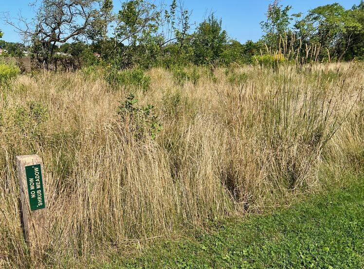
To find the trailhead, park in the lot at the western end of Walnut Avenue and walk north on the lovely paved trail. Find the trailhead on the left past the “No Mow Shrub Meadow.” This sign marks the trailhead.

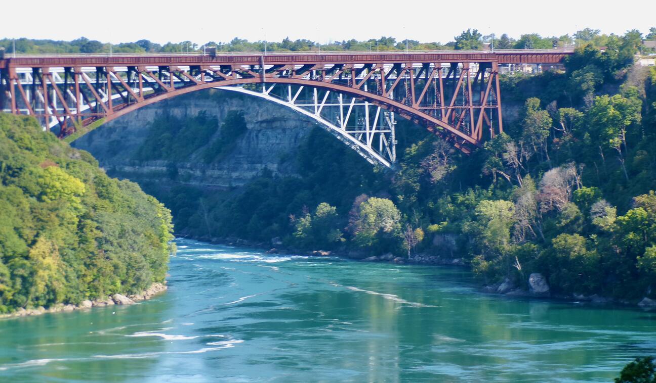
The trail follows the gorge down to the base of the railroad bridge to Canada, near the first set of rapids below the falls in the Niagara River.
The trail dead-ends just past the railroad bridge. Thus, there is no point-to-point trail. It has to be out and back. If you park at the recommended lot, the whole distance is 2.7 miles with elevation gain of 358 feet, all of which is on the return leg.
Please be extra cautious near the edge of the river. The Niagara River is not forgiving to those that fall in. ![]() .
.
Leave No Trace, Ten Essentials
Section titled “Leave No Trace, Ten Essentials”While you’re enjoying the outdoors, please leave no trace![]() to minimize your impact and preserve these special places for others to use as well. If you’re walking or hiking, please pack the REI ten essentials
to minimize your impact and preserve these special places for others to use as well. If you’re walking or hiking, please pack the REI ten essentials![]() for your own safety. When cycling, consider using this REI checklist
for your own safety. When cycling, consider using this REI checklist![]() . For other activities, review the hiking and biking essentials and use your judgment.
. For other activities, review the hiking and biking essentials and use your judgment.

Trail Surface
Section titled “Trail Surface”Don’t let the paved trail that provides access to the Great Gorge Railway Trail fool you. The trail itself starts off well enough with fine crushed stone. Soon, the stones are larger, some as large as railroad ballast. There is also some hard-packed earth and grass on the way.
Please consider carefully whether this trail surface is suitable for your activity.
Restrooms
Section titled “Restrooms”There are no public restrooms at the trailhead or along the trail. There may be public restrooms in Great Lakes 360 (formerly Niagara Gorge Discovery Center). There are definitely restrooms farther north at Whirlpool State Park.
Parking
Section titled “Parking”Park at the public lot at the western end of Walnut Avenue. On some maps, it is labeled Niagara Gorge Discovery Center Parking. There is plenty of parking here with several accessible spots.
Points of Interest
Section titled “Points of Interest”Points of Interest include:
- Several side paths with gorge views.
- Great views of the railroad bridges to Canada. You’re right under them near the end of the trail.
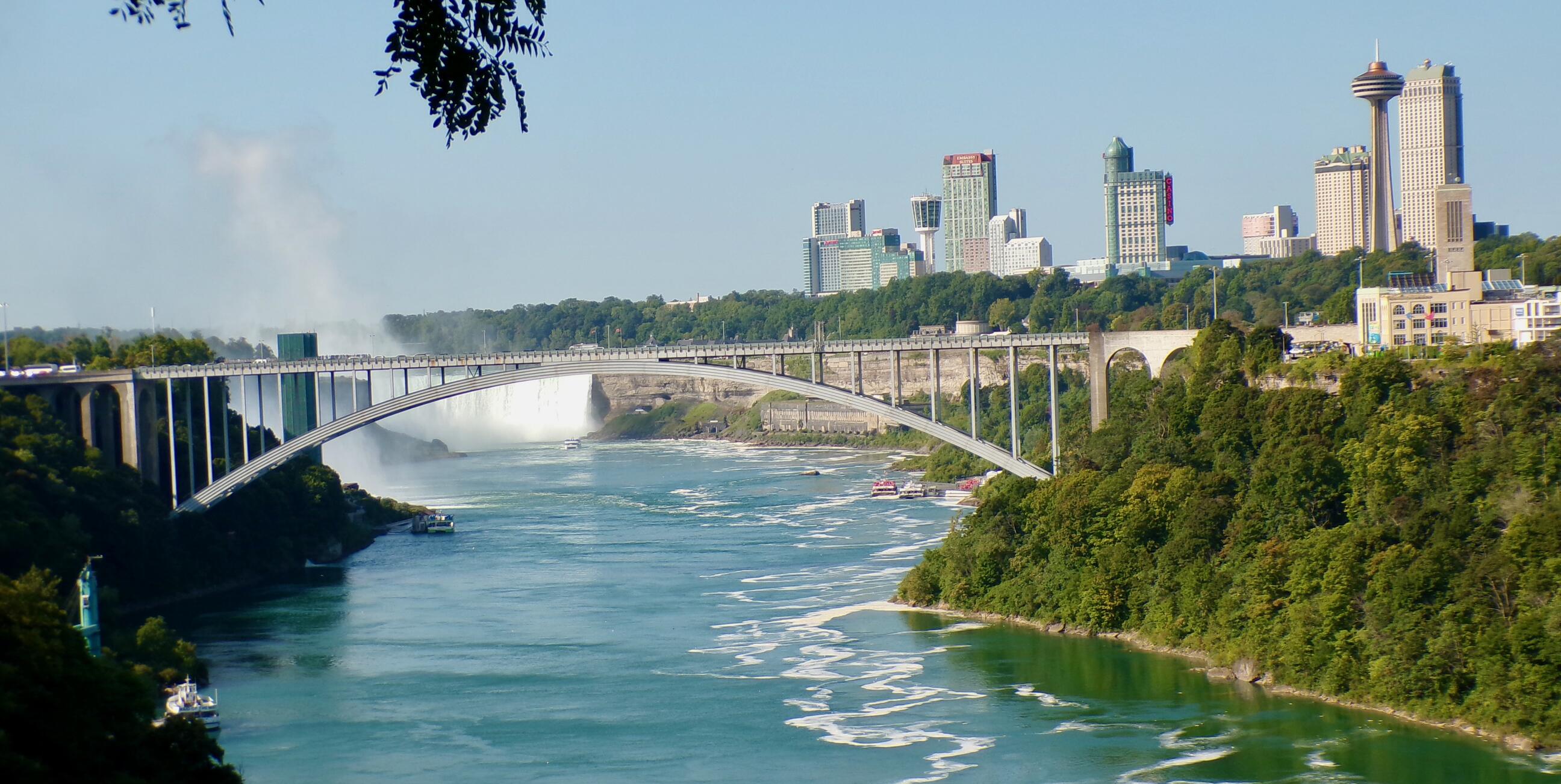
- Views looking south at the Rainbow Bridge to Canada, the Canadian Falls, and the city of Niagara Falls, Ontario, Canada.

- Gorge stone cliffs.
- Niagara River rapids downstream of the falls and upstream of the Whirlpool Rapids.
History
Section titled “History”In The Great Gorge Route (1895 - 1935)![]() , Western New York Heritage site reports:
, Western New York Heritage site reports:
In 1895, the International Railway Company (IRC, predecessor of the NFTA) bought a rail line and established the Great Gorge Route scenic attraction. This electric trolley line ran from Niagara Falls (Prospect Park) to Lewiston, NY along the banks of the Niagara River. Up to 10 cars ran at a time, carrying enthralled visitors just a few feet away from the whirlpool rapids, Devil’s Hole, the Narrows, and the Giant Rock.
Below is text from a 1901 guidebook sold to Pan-American visitors. By many accounts, those visitors did indeed make their way to Niagara Falls before or after their Exposition stay.
The Great Gorge Route
The most magnificent scenic route in the world. This line is a marvel of skill and ingenuity in electric railway building; double-tracked its entire length and provided with every safety appliance known to modern railroad building, it is absolutely safe. One who simply views the Falls sees only a part of the wonders and beauties of Niagara.
…
Historically, the Great Gorge Route was safe, with the exception of the 1917 accident in which a car left the tracks and plunged into the river, killing around 50 passengers. The trolley line ceased in 1935, victim to the Depression and the change in tourist transportation preferences (bus and automobile). The track lines were essentially abandoned and today are used by hikers as part of the Niagara Gorge Trail.
Trail Summary
Section titled “Trail Summary”| Distance | 1.1 miles point to point | 2.2 miles out and back, 2.7 miles to and from parking lot |
| Elevation gain | 358 feet | |
| Trail surface | Fine crushed stone, larger gravel and stones, railroad ballast, and grass. | |
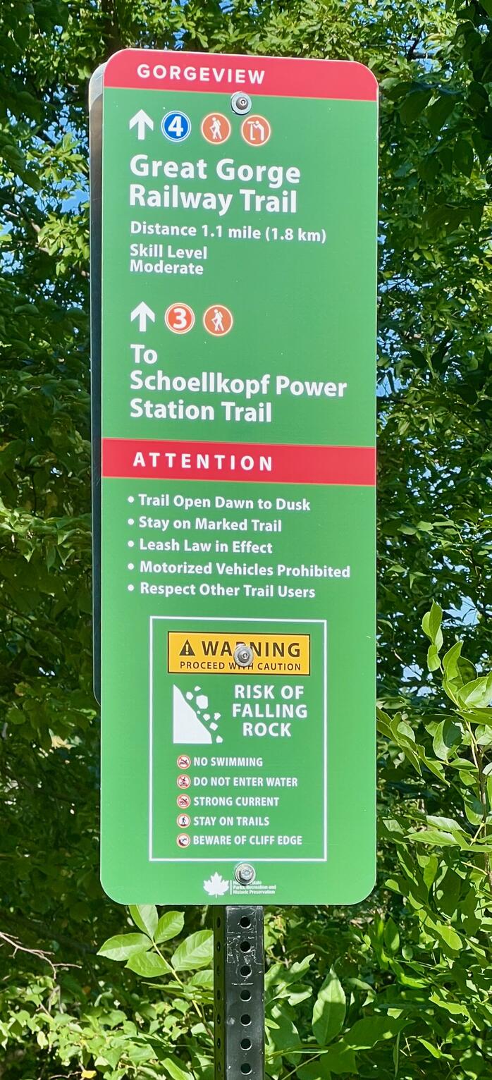
| Difficulty | The trailhead sign says “moderate” | |
| Niagara Gorge Discovery Center Parking | 43.092527, -79.062002 | plenty of parking here with several accessible spots |
| Trailhead | 43.096923, -79.060424 |
All Trails
Both free![]() and premium All Trails accounts provide the capability to load and navigate this map. Tap/click the trail name on the map to enlarge. Scan the QR code to load the map into All Trails app on your smartphone.
and premium All Trails accounts provide the capability to load and navigate this map. Tap/click the trail name on the map to enlarge. Scan the QR code to load the map into All Trails app on your smartphone.
Why have we chosen All Trails for maps for this site?
