Rosie Billquist Nature Trail Segment of the CR2T, Sherman, NY

The Rosie Billquist Nature Trail of the Chautauqua Rails To Trails (CR2T)![]() is a 0.9 mile nature and rail trail near Sherman, Chautauqua County, NY. The downtown Sherman trailhead is behind The Cornerstone Restaurant & Bakery and proceeds east along French Creek to the railbed. At the railbed, the trail turns north and goes approximately ½ mile to Park Street. The total elevation gain is 50 feet.
is a 0.9 mile nature and rail trail near Sherman, Chautauqua County, NY. The downtown Sherman trailhead is behind The Cornerstone Restaurant & Bakery and proceeds east along French Creek to the railbed. At the railbed, the trail turns north and goes approximately ½ mile to Park Street. The total elevation gain is 50 feet.
If you park at the village lot, go to the trailhead, traverse the trail, and return to the parking lot via Park Street, the total distance is 1.66 miles and the elevation gain is 62 feet.
Leave No Trace, Ten Essentials
Section titled “Leave No Trace, Ten Essentials”While you’re enjoying the outdoors, please leave no trace![]() to minimize your impact and preserve these special places for others to use as well. If you’re walking or hiking, please pack the REI ten essentials
to minimize your impact and preserve these special places for others to use as well. If you’re walking or hiking, please pack the REI ten essentials![]() for your own safety. When cycling, consider using this REI checklist
for your own safety. When cycling, consider using this REI checklist![]() . For other activities, review the hiking and biking essentials and use your judgment.
. For other activities, review the hiking and biking essentials and use your judgment.
Trail Surface
Section titled “Trail Surface”
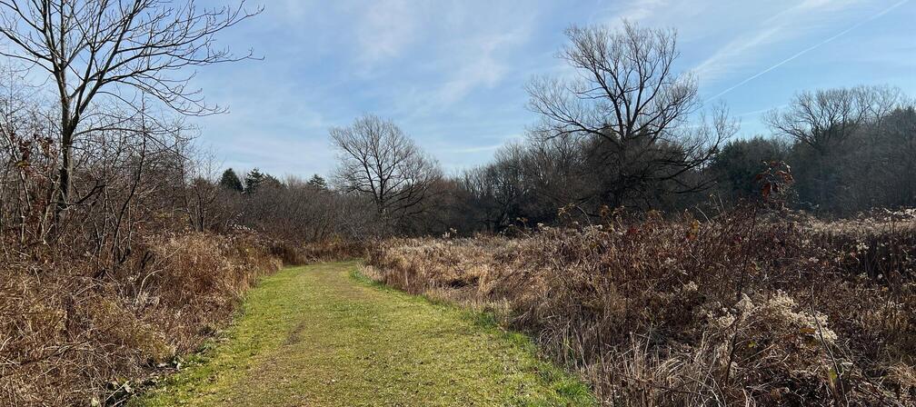
The nature trail portion of the trail is mostly grass while the rail trail portion is grass and gravel.
Please consider carefully whether this trail surface is suitable for your activity.
Restrooms
Section titled “Restrooms”There are no public restrooms at the trailheads or along the trail.
Parking
Section titled “Parking”Park in the village parking lot at the corner of Park and Willard Streets. From there, it is 0.2 miles to the trailhead. This parking lot has plenty of spaces but is heavily used during the week and during events at the adjacent park. Can you park at the trailhead? Perhaps, but it is not designated parking for the trail or for the public.

Points of Interest
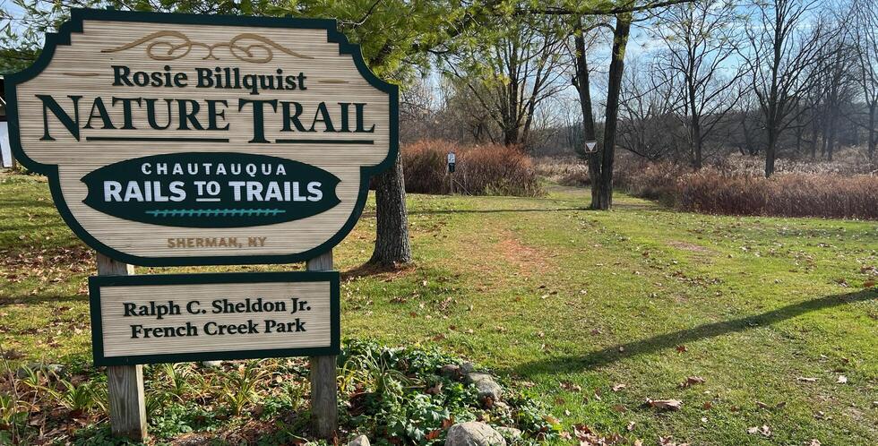
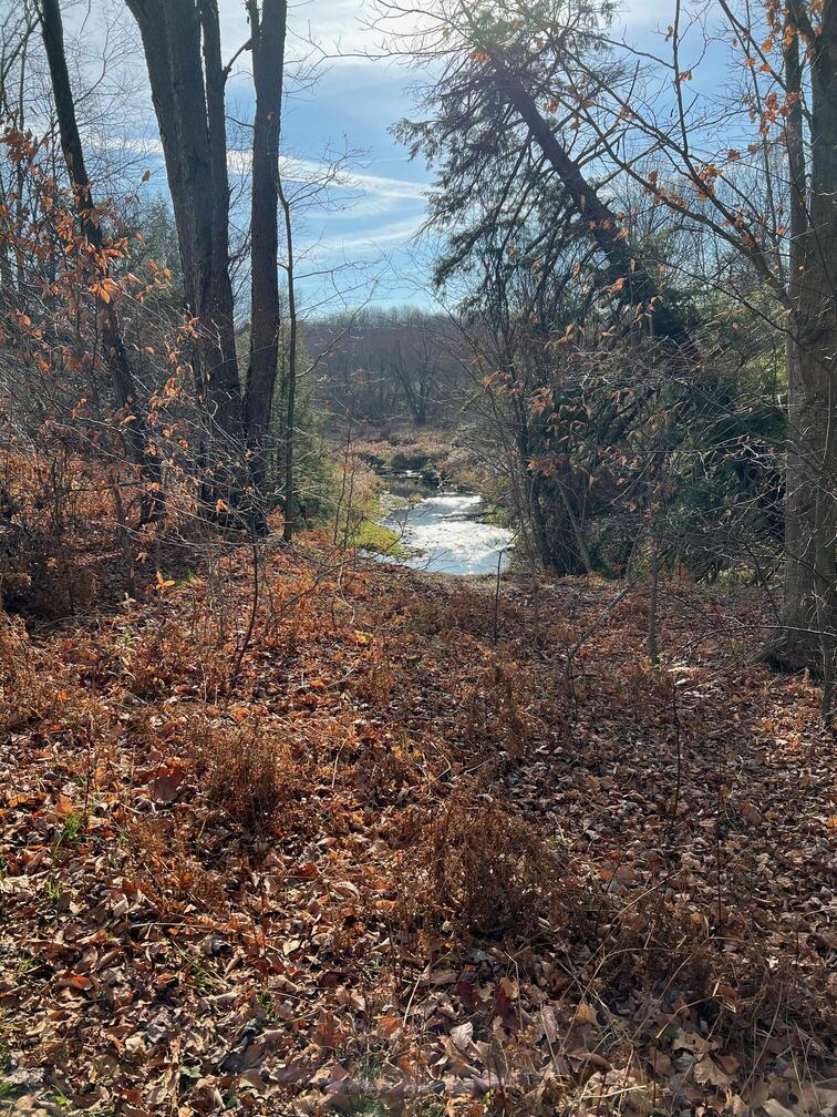
Section titled “Points of Interest”Rosie Billquist Nature Trail proceeds along French Creek in Ralph C Sheldon Jr French Creek Park![]() . This section of the trail is a wonderful little nature park with many reported wildlife sightings among a diverse area of wetlands, woodlands, farms, and homes.
. This section of the trail is a wonderful little nature park with many reported wildlife sightings among a diverse area of wetlands, woodlands, farms, and homes.
History
Section titled “History”In the 1970s, the abandoned rail lines in the eastern area of the Village of Sherman were removed. The unused corridor was transformed into a recreation trail as a part of the Chautauqua Rails-to-Trails program, which created the Sherman Recreational Trail along the former rail route through the Village. Today, the path of the historic rail lines is still a physical presence through the community, but instead of an unused eyesore, this area has now been transformed into a unique and revitalized feature for the Village of Sherman.
From Nature Trail In Sherman Renamed After Rosie Billquist, The Post-Journal, Sep 6, 2019![]() :
:
A sign dedicating the Rosie Billquist Nature Trail at the Ralph C. Sheldon Jr. French Creek Park will officially be unveiled during a ceremony Saturday at noon. Billquist, an avid runner and cyclist, was killed in November 2017 in a hunting accident near her home.
The ceremony is being organized by Chautauqua Rails To Trails and the village of Sherman.
Bree Agett, vice president of the nonprofit outdoor group, said the particular stretch of trail had no official name beyond “Village of Sherman Nature Trail.” A native of Sherman herself, Agett said it “made sense” to name the trail after Billquist.
“She was an avid biker and runner,” Agett said. “It just made a lot of sense to rename the trail in an area where she grew up.”
Hiking Solo (and Running, etc.)
Section titled “Hiking Solo (and Running, etc.)”Solo hikers who find themselves able to do the whole point-to-point trail distance but not the out and back may consider using Uber or Lyft to get a ride from where they parked to the other trailhead. Warning: this trail is in a less populated area. You may have to wait 15 minutes or more for a ride or you may not get a ride at all. I got stranded at a trailhead once and could not get back to my car at the other trailhead. Thankfully, it was close enough home that my wife picked me up. But I have done this successfully in more populated areas.
Trail Summary
Section titled “Trail Summary”| Distance | 0.9 miles point to point | 1.8 miles out and back |
| Elevation gain | 50 feet | |
| Trail surface | Grass and gravel | |
| Difficulty | Easy | |
| Village of Sherman parking lot | 42.16064, -79.59351 | Large lot, paved, striped |
| Franklin Street trailhead | 42.15875,-79.59497 | Parking maybe, no signs for or against |
| Park Street trailhead | 42.162818, -79.585296 | No parking |
All Trails
Both free![]() and premium All Trails accounts provide the capability to load and navigate this map. Tap/click the trail name on the map to enlarge. Scan the QR code to load the map into All Trails app on your smartphone.
and premium All Trails accounts provide the capability to load and navigate this map. Tap/click the trail name on the map to enlarge. Scan the QR code to load the map into All Trails app on your smartphone.
Why have we chosen All Trails for maps for this site?
This route shown below is out and back starting and ending at Franklin Street trailhead.
