Corry Junction Greenway Trail, Corry, PA, to Clymer, NY

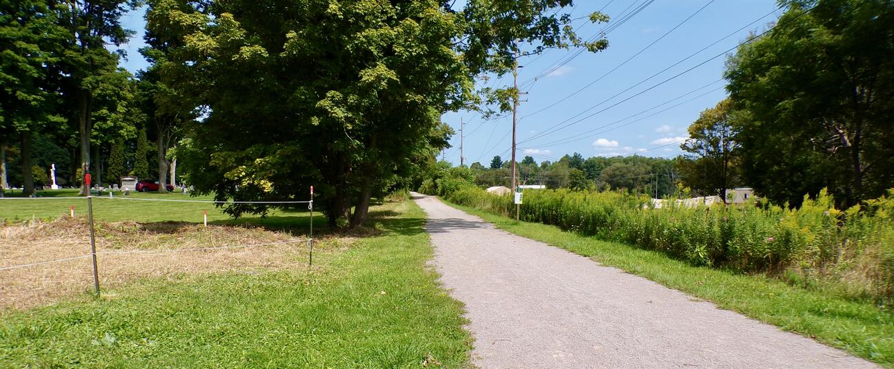
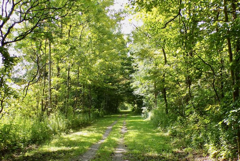
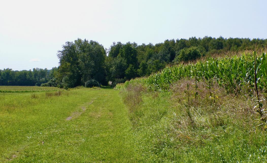
The Corry Junction Greenway Trail is a 6.5 mile rail trail between Corry, PA, and Clymer, NY. The southern trailhead is on North Center Street adjacent to Corry Concrete, Inc., 1244 N Center St, Corry, PA 16407. The northern trailhead is in Clymer at the confluence of Rundall and Caflisch Roads. This is a former railbed of several railroads. See History section below. Along the trail, you’ll find mostly woods and some farmland. There is a baseball field near the Corry end.

Leave No Trace, Ten Essentials
Section titled “Leave No Trace, Ten Essentials”While you’re enjoying the outdoors, please leave no trace![]() to minimize your impact and preserve these special places for others to use as well. If you’re walking or hiking, please pack the REI ten essentials
to minimize your impact and preserve these special places for others to use as well. If you’re walking or hiking, please pack the REI ten essentials![]() for your own safety. When cycling, consider using this REI checklist
for your own safety. When cycling, consider using this REI checklist![]() . For other activities, review the hiking and biking essentials and use your judgment.
. For other activities, review the hiking and biking essentials and use your judgment.

Trail Surface
Section titled “Trail Surface”From the Corry trailhead to Hereford Road, just over a mile, the trail surface is wide, with crushed stone. The majority of the trail, however, is two tracks with grass, some gravel. There is one short section that has been heavily eroded into larger stones, some as big as baseballs.
Please consider carefully whether this trail surface is suitable for your activity.
Restrooms
Section titled “Restrooms”There are no public restrooms at the trailheads or along the trail.
Parking
Section titled “Parking”There is a small lot for about 6 cars at the Corry trailhead. It is not paved, not striped, and not marked accessible. There’s a much larger parking lot where the trail intersects with Hereford Road. Again, this lot is not paved, striped, or marked accessible.
Points of Interest
Section titled “Points of Interest”Points of Interest include:
- Farmland
- Baseball field
- Woods
- Wildlife
- Serenity
- Several very nice bridges

History
Section titled “History” Corry History ![]() tells the story of Corry’s origin and significance of the Junction.
tells the story of Corry’s origin and significance of the Junction.
On September 13, 1858, Amos Harrington purchased 93 acres of land, on which the city of Corry is presently located. The same year, he sold 63 acres to Hiram Cory, for whom the city is named. Cory built his home on West Washington Street.
In 1861, one of the most significant buildings in Corry’s history was built: a small ticket office and eating house. This building was built at the junction of railroads known as the “Atlantic and Erie Junction”. That year, the Atlantic and Great Western Railroad (A. & G.W.) intersected the Philadelphia and Erie (P. &E.) railroad at a small town which was named Junction. In that year, the A. & G.W. Railroad Company purchased a piece of land from Cory. My. Hill, the general superintendant, named the station Corry, in honor of the man’s generous business deal. Unfortunately, he misspelled it on the station name, and the name of Corry was born.
Pennsylvania Railroad Station - U.S. National Register of Historic Places on Waymarking.com ![]() reports:
reports:
The origins of the railroad can be traced back to 1867 with the construction of the Buffalo, Oil Creek and Cross Cut Railroad, a 43 mile line from Corry, PA to Brocton, NY, where it joined the Lake Shore and Michigan Railroad to Buffalo and transported oil and coal to the region. The original station was built in Mayville in 1870 to accommodate the new freight line which operated under the name of Buffalo, Corry and Pittsburgh Railroad.
In 1879, the BC&P reorganized under the name Buffalo, Chautauqua Lake and Pittsburgh Railway, but merged in 1880 to become the Pittsburgh Titusville and Buffalo Railway. By 1881, the Buffalo Pittsburgh & Western Railway gained control after the merger and consolidated three other branch lines. As a result of more mergers, the BP&W became part of a large network known as the Buffalo, New York and Philadelphia Railroad in 1883. In 1887, the BNY&P joined with the Pennsylvania Railroad to become the Western New York and Pennsylvania Railroad. The WNY&P adopted the name Pennsylvania Railroad in 1900.
If you’re into the larger picture of connecting trails, the Erie to Pittsburgh/PA Wilds Gap Assessment Report ![]() by Pennsylvania Envronmental Council and Industrial Heartland Trails may interest you. Sections 5, 6, 7, and 8 focus on the Corry Junction Greenway Trail and possible ways to connect it to trails north in Sherman (Rosie Billquist Nature Trail Segment of the CR2T and Ralph C. Sheldon Jr. Segment of the CR2T) and south.
by Pennsylvania Envronmental Council and Industrial Heartland Trails may interest you. Sections 5, 6, 7, and 8 focus on the Corry Junction Greenway Trail and possible ways to connect it to trails north in Sherman (Rosie Billquist Nature Trail Segment of the CR2T and Ralph C. Sheldon Jr. Segment of the CR2T) and south.
Hiking Solo (and Running, etc.)
Section titled “Hiking Solo (and Running, etc.)”Solo hikers who find themselves able to do the whole point-to-point trail distance but not the out and back may consider using Uber or Lyft to get a ride from where they parked to the other trailhead. Warning: this trail is in a less populated area. You may have to wait 15 minutes or more for a ride or you may not get a ride at all. I got stranded at a trailhead once and could not get back to my car at the other trailhead. Thankfully, it was close enough home that my wife picked me up. But I have done this successfully in more populated areas.
Trail Summary
Section titled “Trail Summary”| Distance | 6.5 miles point to point | 13.1 miles out and back |
| Elevation gain | 216 feet | |
| Trail surface | Some crushed stone and gravel, mostly grass. | |
| Difficulty | Moderate | |
| Corry trailhead and parking | 41.937727, -79.642105 | About 6 cars, not paved, not striped, not marked accessible |
| Hereford Road parking | 41.955626, -79.6395730 | About 20 cars, not paved, not striped, not marked accessible |
| Clymer trailhead | 42.016562, -79.608992 | No parking |
All Trails
Both free![]() and premium All Trails accounts provide the capability to load and navigate this map. Tap/click the trail name on the map to enlarge. Scan the QR code to load the map into All Trails app on your smartphone.
and premium All Trails accounts provide the capability to load and navigate this map. Tap/click the trail name on the map to enlarge. Scan the QR code to load the map into All Trails app on your smartphone.
Why have we chosen All Trails for maps for this site?
