Kinzua Skywalk, Mt Jewell, PA

The Kinzua Skywalk is a 0.25 mile rail trail in Kinzua Bridge State Park, Mount Jewell, PA.

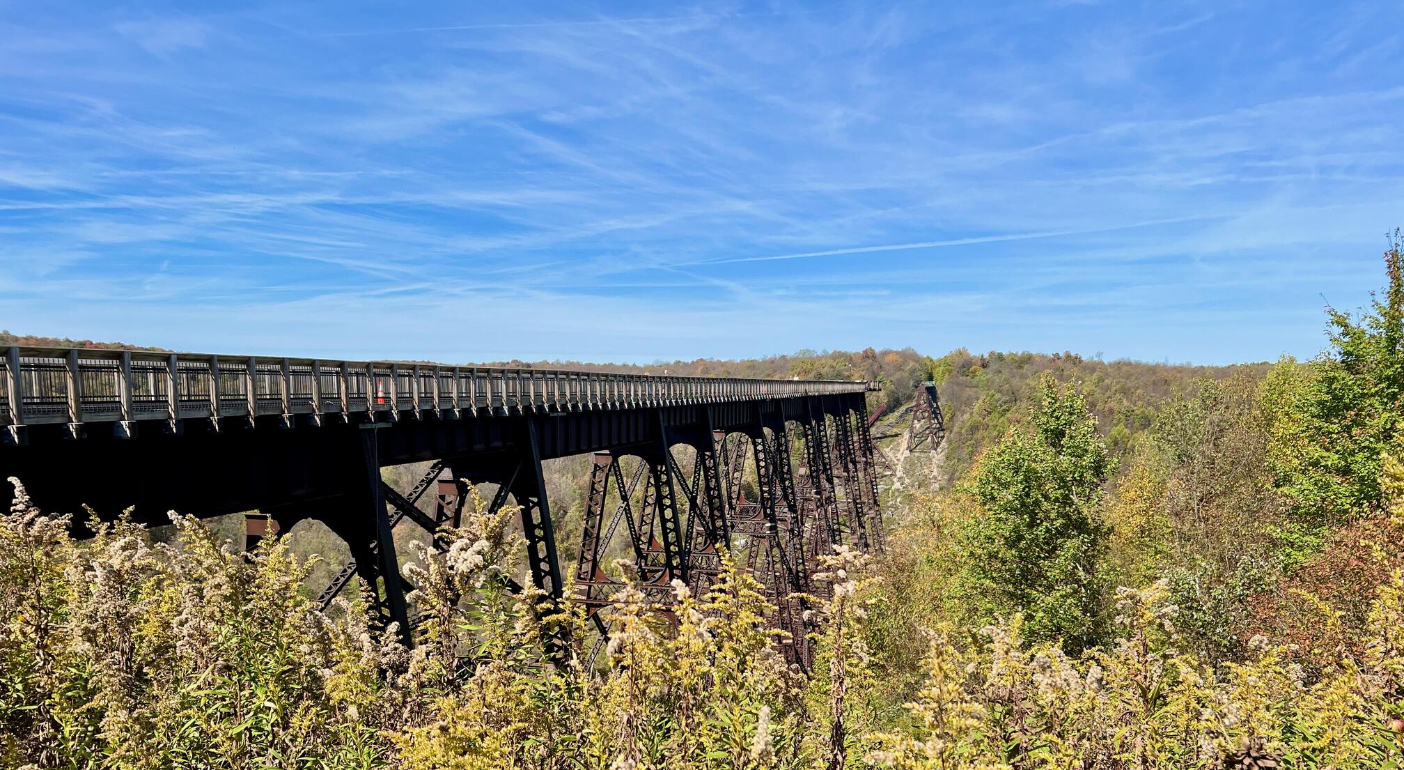
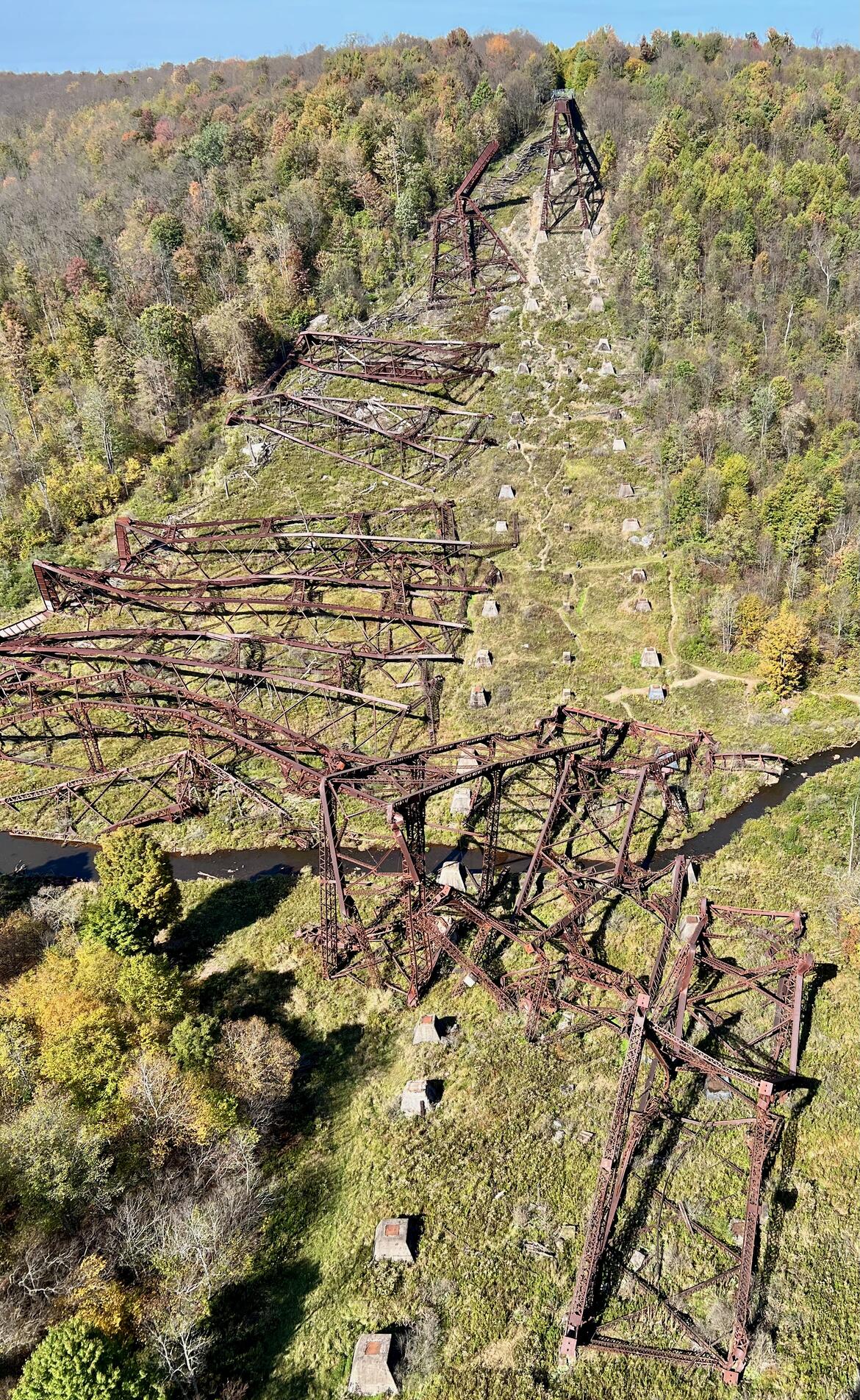
It proceeds from the visitor center to the former railroad bridge across the Kinzua Gorge. It is now a platform for viewing the valley and collapsed bridge structure across the valley floor and up the opposite hill.
Note that the trail and platform will be closed for rehabilitation and preservation ![]() from November 19, 2024, through August 7, 2025. It will reopen from August 8, 2025, through October 31, 2025, and then will be closed again through September 1, 2026.
from November 19, 2024, through August 7, 2025. It will reopen from August 8, 2025, through October 31, 2025, and then will be closed again through September 1, 2026.
Trail Surface
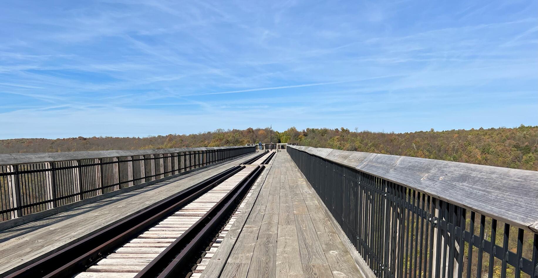
Section titled “Trail Surface”The trail is paved from the visitor center to the bridge platform. The bridge platform is wood and railroad tracks.
Please consider carefully whether this trail surface is suitable for your activity.

Restrooms
Section titled “Restrooms”There are restrooms in the beautiful visitor center.
Parking
Section titled “Parking”There is a large parking lot adjacent to the visitor center. It is paved, striped, and has accessible parking spots.
Points of Interest
Section titled “Points of Interest”The Allegheny National Forest Visitor Bureau ![]() reports:
reports:
Located at the Kinzua Bridge State Park in northwestern Pennsylvania, the skywalk was constructed on six of the historic Kinzua Viaduct massive steel towers remaining after the tornado of 2003. The Kinzua Viaduct was once the highest and longest railroad viaduct in the world.
The Kinzua Sky Walk extends out 624 feet into the Kinzua Gorge offering panoramic views. The skywalk features a walkway with a set of railroad tracks leading to the end of the overlook which has a partial glass floor.
History
Section titled “History” History of Kinzua Bridge State Park ![]() :
:
Construction of the iron viaduct began during 1881, starting with the placement of the stone piers. When completed during 1882, the Kinzua Bridge Viaduct was the highest railroad viaduct in the world. It was constructed as an alternative to laying an additional eight miles of track over rough terrain along the line leading to McKean County’s coal, timber, and oil lands.
Built of iron, the original viaduct was approximately 301 feet high, 2,053 feet long, and weighed 3,105,000 pounds. The towers were a patented design called Phoenix Columns. The columns were lighter in weight and had greater strength than cast iron columns of similar shape and size.
By 1900, it became necessary to rebuild the entire structure with steel to accommodate heavier trains. Later that year, about 100 to 150 men, working 10-hour shifts, completed the job in 105 days. The new steel viaduct had the same measurements, but now weighed 6,706,000 pounds.
Trail Summary
Section titled “Trail Summary”| Distance | 0.25 miles point to point | 0.5 miles out and back |
| Elevation gain | 100 feet | |
| Trail surface | Paved, wood | |
| Difficulty | Easy | |
| Vistor Center trailhead and parking | 41.759527, -78.587204 | Large paved, striped, and accessible parking lot |
All Trails
Both free![]() and premium All Trails accounts provide the capability to load and navigate this map. Tap/click the trail name on the map to enlarge. Scan the QR code to load the map into All Trails app on your smartphone.
and premium All Trails accounts provide the capability to load and navigate this map. Tap/click the trail name on the map to enlarge. Scan the QR code to load the map into All Trails app on your smartphone.
Why have we chosen All Trails for maps for this site?
